Realtors and
Title Agents Welcome
message Monthly
meetings Events /
Calendar
Title Agents Welcome
message Monthly
meetings Events /
Calendar
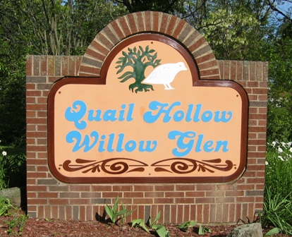
You have found the web site of the Gander Road Homeowners Association.
Our association is a combination of the subdivisions of Quail Hollow
and Willow Glen, located in the northeast corner of Dayton, OH.
The GRHA Board of Trustees meets the 2nd Thursday of every month at 7:00pm at the Huber Heights Chamber of Commerce, 6428 Chambersburg Rd, Huber Heights, OH 45424.
This meeting is open to all members of the GRHA.
(Click here for map to Huber Heights Chamber of Commerce)
Meeting Minutes can be found in the Quail Call newsletter

All questions regarding the status of dues payments and/or liens on
a particular property should be directed to our Treasurer,
phone: email: Email is preferred and usually the best way to contact.
Gander Road Homeowners Association P.O. Box 24763 Dayton, OH 45424-4763
Board of Trustees
Public Relations
The Public Relations Committee takes care of the various events that the GRHA hosts. We have an Easter Event, a Spring Garage Sale, a Halloween Event, Halloween Donut stations, and a Christmas decorating contest.Architectural Control
Our neighborhood has an Architectural Control Committee put in place by the Board of Trustees in accordance with our DECLARATION OF COVENANTS. A set of Architectural Guidelines has been developed. In accordance with the Declaration ALL external construction on any lot must be submitted to the Architectural Control Committee for approval before the construction begins. This includes but is not limited to: fences, decks, patio rooms, and sheds. Properties are also subject to the City of Dayton Zoning Code, which may require permits for building.Green Areas
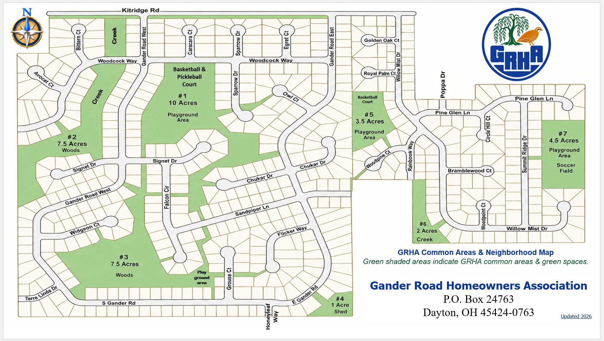
The Green Areas of the GRHA are 7 different park areas totaling approximately 36 acres of space. Several of the Green Areas include playground equipment and there are also 2 with basketball courts and one with a soccer field. Some of the areas are only grasslands with trees and bushes. All of these areas are for the usage and enjoyment of all of the members of the association. As the single biggest asset of the association, the Green Areas take up much of the board's energy and time to administer.Welcoming
The Welcoming committee maintains the welcome packages that we deliver to new members when we get notice of sales on properties.Quail Call Newsletter
The Quail Call newsletter is the primary communication method of the Gander Road Homeowners Association. We do a Quail Call every month except January and it is printed and hand delivered to all 543 members of the GRHA. In the newsletter we do a President's message, calendar of events, meeting minutes from mothly board meetings, neighborhood news and happenings, helpful tips, member classified ads, paid ads, and a list of Trustee and Committee contacts.Nominating
The GRHA is managed by volunteer trustees who are elected at the annual meeting of the general membership. GRHA trustees receive no monetary compensation for their efforts, but authorized expenses are reimbursed. However, trustees help our neighborhood tremendously and have opportunities to work with their neighbors and community leaders.Nominees must be a member, in good standing, of the Gander Road Homeowners Association.